
Cautley Spout, Calf, Bram Rig Top, Calders, Arant Haw & Winder
Magnificent Howgill Fells
Summary
The Howgills, a place I have longed to explore more of. With its long rounded grassy hills, a mixture of valleys, steep grass paths, bogs, grassy slopes, broad high mountain ridges, streamside paths, and mountain ridges. It’s somewhere one can wonder and not see anyone for miles. Which is why the locals call it ‘The Hidden Howgills’- The remoteness is what attracts me the most. However, every time I have ventured to the area the weather has been terrible. This time it was different.
‘If the Lake District is the honey pot and the Yorkshire Dales the jam pot, then the Howgill Fells must be the marmalade pot. No less sweet; just not to everybody’s taste’.
The Hike
Finally, the UK was hit with some good weather. It was the perfect opportunity to see the Howgills without being shrouded by clouds and rain. Although I wasn’t sure what to expect, as this could change with any sort of high uplands. I had hoped it was my day, even if the met office had said cloud throughout. Never believe the weather forecast is my motto. Sometimes it’s worked in my favour, sometimes it hasn’t.
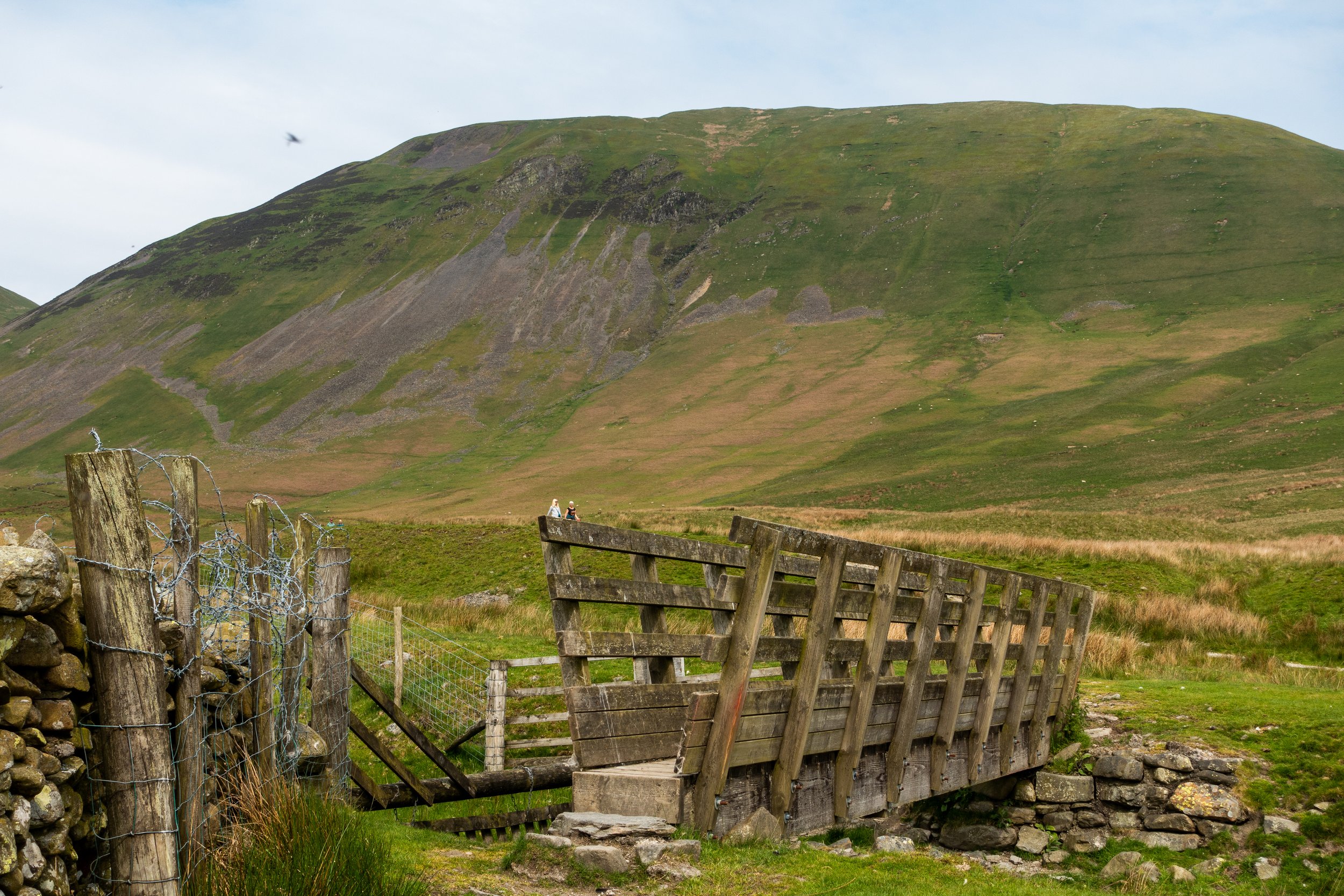
I started my adventure in the quiet village of Sedbergh where I parked. From the village, I took a quiet gravel track after veering off the main road. Taking me onto open farmland fields, rising ever so slightly in elevation. It was joyous to roam the valley floor beside the dry-stone wall line. The high peaks of the Northern Dales surrounded me and knew I'd end my day on the open ridge line. While on the route, I came across a narrow single track on a steep hillside that was covered with yellow Gaws! Standing out like a sore thumb.


While walking down the path, I started descending towards the base of the hills. I wasn't ready for what I was about to witness. As I turned a corner, the first fell presented itself. It was humongous! I can see why Alfred Wainwright described them as ‘herd of sleeping elephants’. The grass that covered the rounded hills looked almost like the stretched skin of a large animal sleeping. To say I have been slogging myself up there in thick clouds before. It’s no surprise I found it hard.
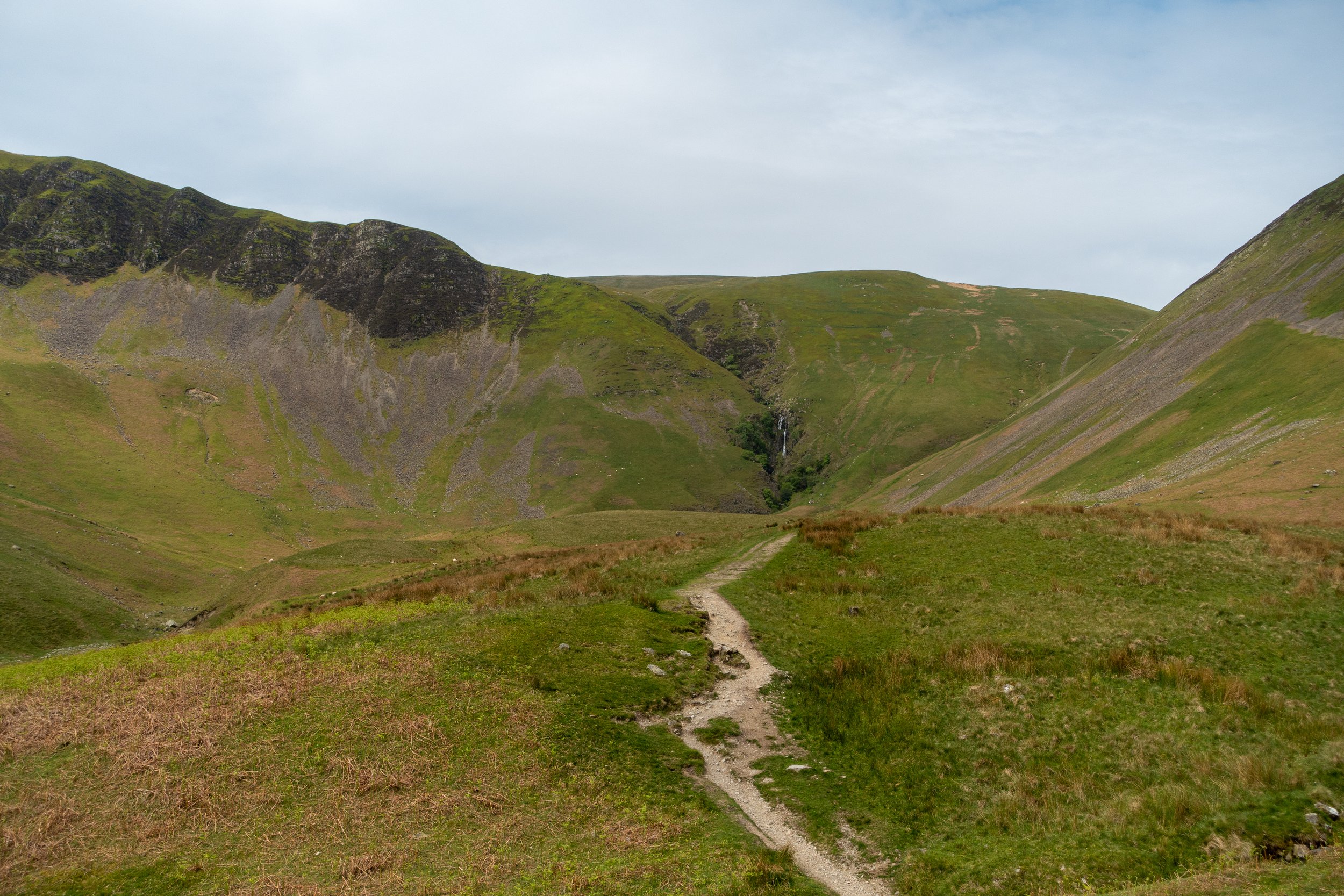
I had walked through the valley before, but this time the mounded hills were clearly visible. Cautley Spout was especially stunning - it is England's highest waterfall, with a drop of 600 ft. In the distance, I could see the long rising hill that climbed beside the waterfall. It looked extremely steep, although it wasn’t long to get to the top, but it felt like an eternity. Regardless of how steep it was, I took my time, stopping every so often to take in the view that lay behind me. ‘This is incredible, I thought.
Continuing from the summit, the path traversed another peaceful, desolate valley that felt undiscovered. I felt like I was in a remote place. So far away from everything, and yet, I didn’t feel alone. After taking a moment to soak in the scenery. I started climbing towards the Calf, the highest point in the Howgills. I followed a long rising track carved into the valley slope that appeared to extend for a considerable period. The beautiful V-shaped valley behind me unfolded its view as I gained height. The stream meanders through the middle, flanked by sloping hills on either side and the clouds above. Painting a colourful backdrop. Free from bracken and trees. The sight was truly majestic. As I made my way out of the valley, I was presented with a spectacular view of the rolling green giants. I had never seen in the Howgills like this before. It was pure bliss.


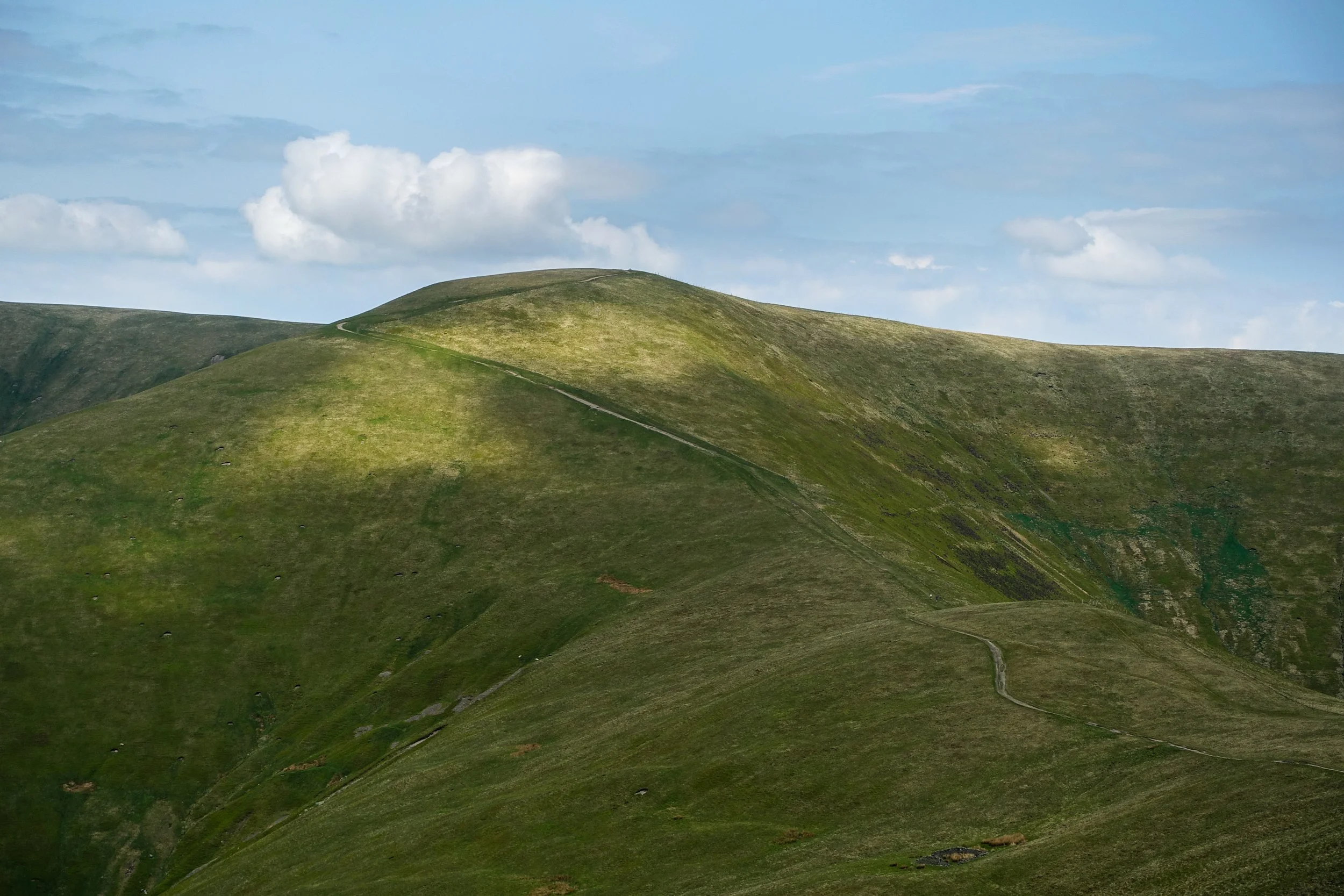
Afterwards, I trundled upwards to the trig again, and by this point, everyone had disappeared. I was at the highest point in the Howgills, halfway through my hike, but I was very excited to explore the rest. The track meandered over vast, open short, grassed hills towards Bram Rigg Top & Calders. A few more undiscovered fells, both at which are part of the Dale’s 30. The wide and sweeping ridgeline descended leisurely enough for me to enjoy the character of these pert hills. With every curve, this created deep, shadowy valleys. I loved it.
Arant Haw was the next summit to conquer, identified by a small cairn and a wooden post and commonly referred to as higher Winder. While walking along the easy trail, I encountered a few additional hikers and began to descend sharply towards a small rock heap. I was in awe of the view as I approached. The ridge was characterized by mammoth, curved hills and a path that snakes along it. I saw a hiker on the trail who appeared no larger than an ant which put it into a perspective of how big these green giants are.
By following the path, I ended up at the final summit, Winder. Although when I arrived, there was a crowd of lads already there. I waited for a while so I could enjoy it for myself and soak up the incredible views of the Dales. Descending from Winder was quite a challenge due to its steepness. My thighs were in bits. Sometimes I think it’s worse descending than ascending, purely because it hurts my legs more.
Eventually, I made it to the valley floor. I wondered along the path, taking me through a secluded woodland and back onto the main village and back to the car.
I loved every minute of this hike, purely because of the good weather. It makes such a difference.
GPX
Gallery