

Yorkshire & The Dales
God’s Own County
The Yorkshire Dales National Park and Yorkshire itself is a beautiful place, hence the name ‘God’s own country. The history and landscape allures people from all around the world and has a bit of everything for everyone. I have always lived on the edge of the Dales, and visited regularly ever since I was a young lad. However, I never truly appreciated the area until in my late 20’s where I began to cycle and hike/walk more regularly. I found my hunger and curiosity grew the more I visited, immersing myself in the landscape.
Below you will find the hikes/walks that have ratings of difficulty and contain mainly my own stories, routes, GPX files and, photographs. Some longer than others. I hope others can enjoy their own Yorkshire adventure like me.
BLOGS & ROUTES

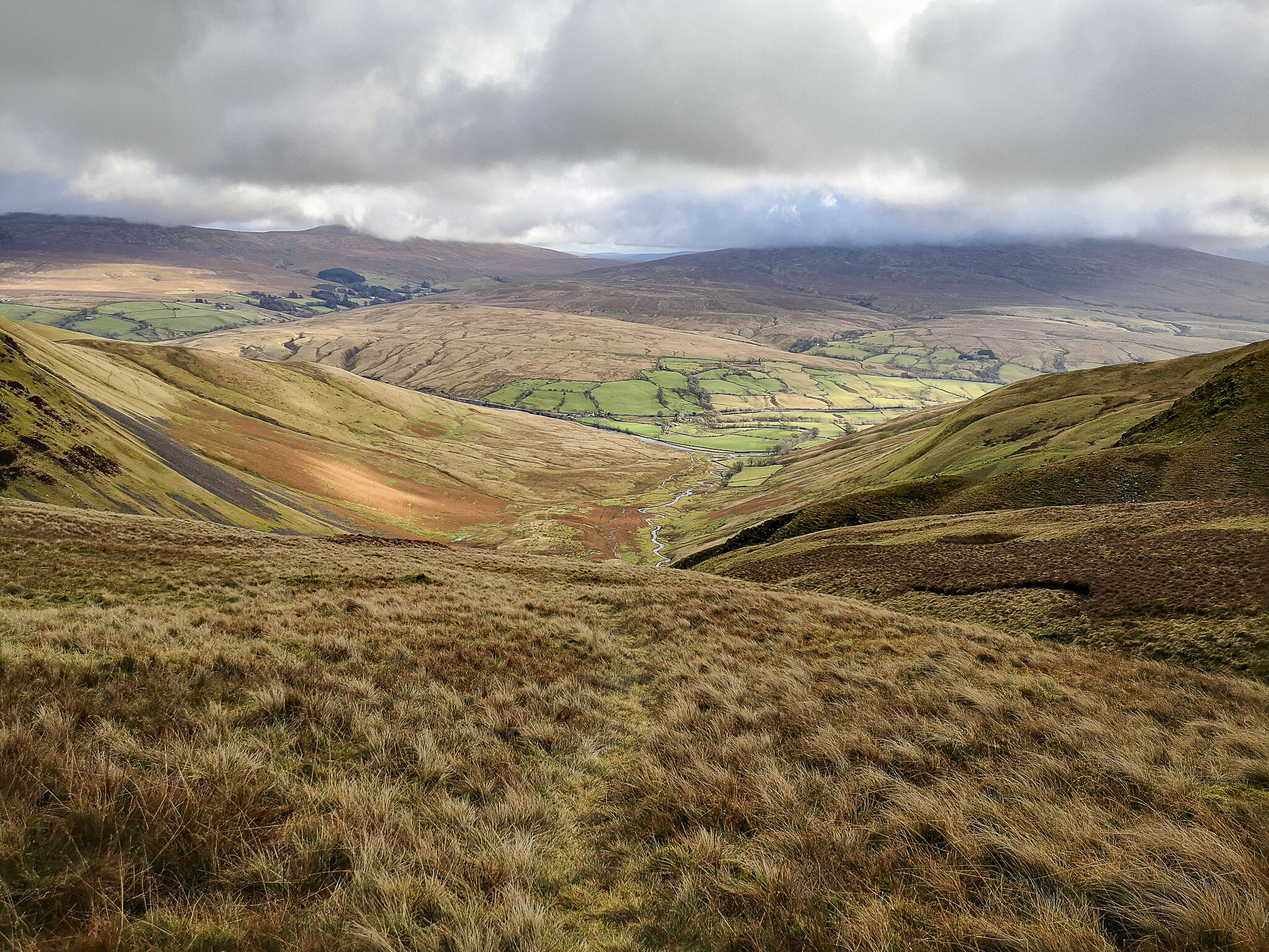
Simon’s Seat & The Valley of Desolation
An iconic and popular walk in the heart of the Yorkshire Dales. Simon’s Seat is at a height of 485m and although it’s not particularly high, it’s well worth a visit. Not to mention the views over the Dales are breathtakingly beautiful - especially if you catch a cloud inversion like I did.
Distance: 9 miles / 14.5km
Location: Barden Bridge

Old Cote Moor
Enjoy beautiful views over the Old Cote Moor. A challenging hilly trail that climbs up rocky terrain and along a grassy plateau, where fantastic views across the Yorkshire Dales open over upper Wharfedale. Head back into the valley of Kettlewell and continue up the steep hillside above Buckden and back towards Arncliffe. A challenging but rewarding hike.
Distance: 8 miles / 12.8 km
Location: Arncliffe

Black Force, Spout, Fell Head & Linghaw
An excellent walk to the summit of Fell head through the majestic valley of Carlingill Beck via Black Force and the Spout. A remote part of the Cumbrian Dales, hardly visited, with stunning views of the Lake District, Yorkshire Dales, and the M6.
Distance: 6.5 Miles / 10.5 Km
Location: Sedbergh

Stainforth via Smearsett Scar & Giggleswick Scar
The small village of Stainforth is in the craven district of North Yorkshire. Nearby, there is Stainforth falls, which is renowned for wild swimming and is easily accessed on foot. From the falls, the walk rises high above the village, offering magnificent views of dramatic limestone and rocky outcrops towards the hamlet of Feizor.
Distance: 9 Miles / 14.5km
Location: Stainforth

Barbondale
Barbondale and Calf Top is a geographer’s dream. With a steep-sided valley carved out through the landscape from the ice age, Barbon beck meanders throughout, and a broad wide grassy unspoiled ridge offers extensive views into the Howgills.
Distance: 9 miles / 14 km Location: Barbon

Birks Fell
Birks Fell is situated in-between the valleys of Wharfedale and Littondale. Until recently, it has been labelled as a Marilyn. A peak that is above 2000ft, which is also classified as part of the Dales 30.
Distance: 9 miles / 14 km Location: Starbottom

Plover Fell
Plover Fell is Pen-y-Ghent’s neighboring Fell. It is one of the more remote and least accessed, however, that’s what makes it so special. It also contributes to one of the Dales 30 with it being over 2000ft in height. The hike itself starts from the quiet village of Halton Gill in Littondale in the Yorkshire Dales.
Distance: 9 miles / 14 km Location: Halton Gill

Great Whernside
Contributing to part of the Dales 30, Great Whernside is one of many mountains in upper Wharfedale, starting and finishing in the modest village of Kettlewell. Although the route can be challenging on foot in parts, as the terrain is slightly rougher. This makes for an excellent microadventure high up in the fells of the Yorkshire Dales.
Distance: 8 miles / 13km
Location: Kettlewell
Howgills Fells
Starting from Sedburgh on the border of the Yorkshire Dales in Cumbria. This is a walk that entails a day out through the rolling hills of the Howgills fells.
Distance: 12 miles / 19km
Location: Sedburgh

Great Shunner fell & lovely seat
Located on the north side of the Yorkshire Dales just off Hawes in a small town called Hardraw. I parked on a lay-by near the Hardraw sign. Here I began the walk which was on clear paths up to Cotterdale.
Distance: 11 miles / 18 km
Location: Hardraw
Links


